Environmental Data Analysis and Visualization
Visualization Critique
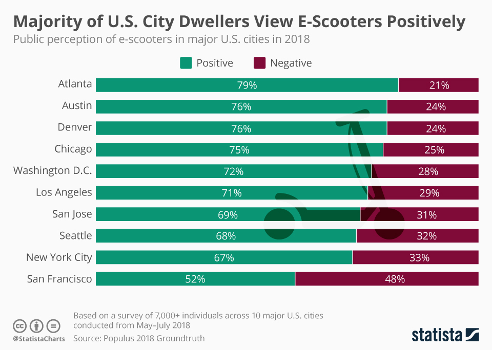
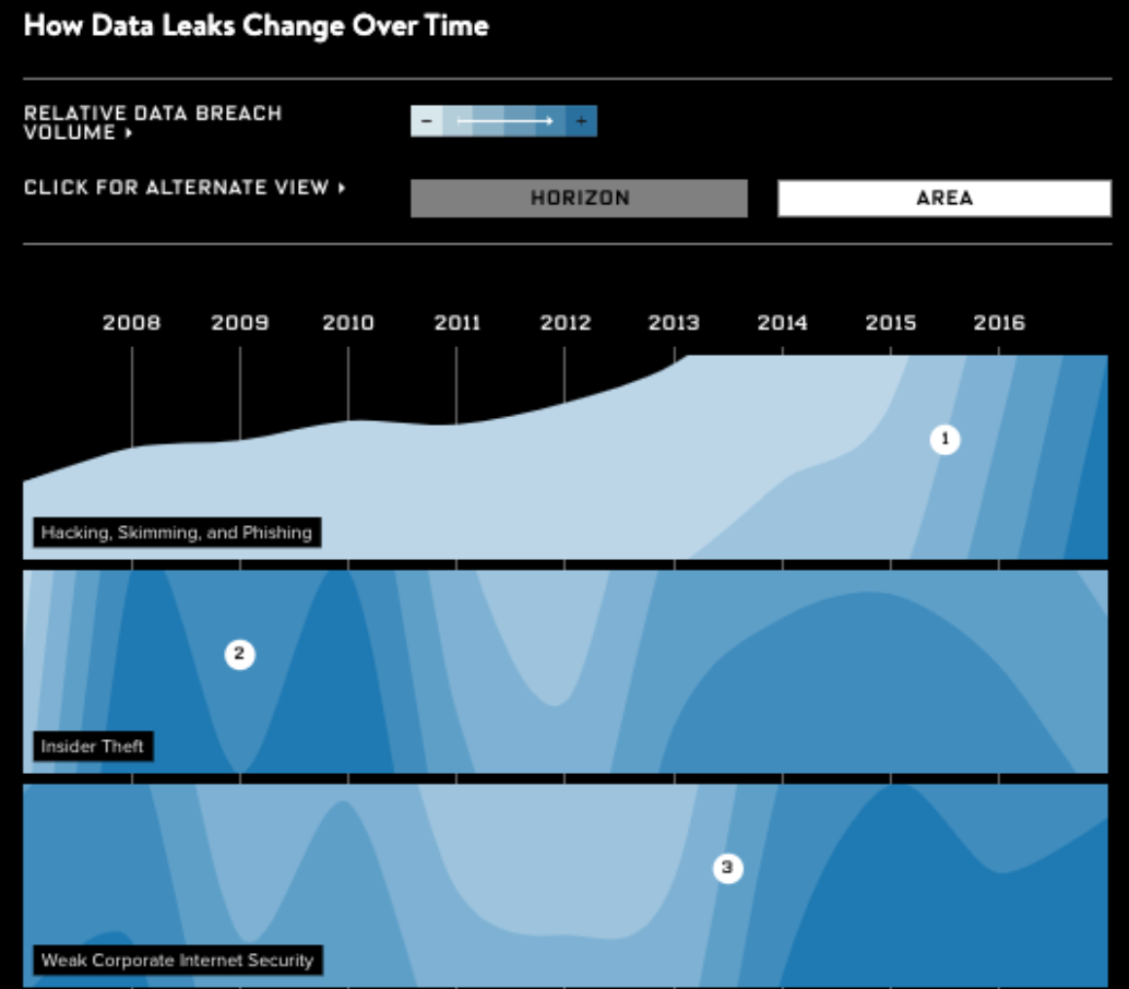
Visualization Critique
Next week’s critiques
Ned
Mariana
Dataset of the Day
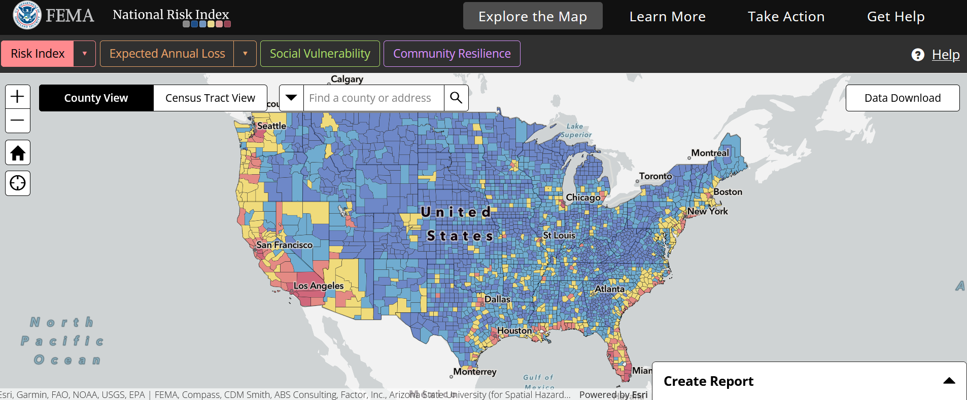
FEMA National Risk Index
Effectively communicating with visuals
What’s the headline?
Drawing the eye
Conveying the mood
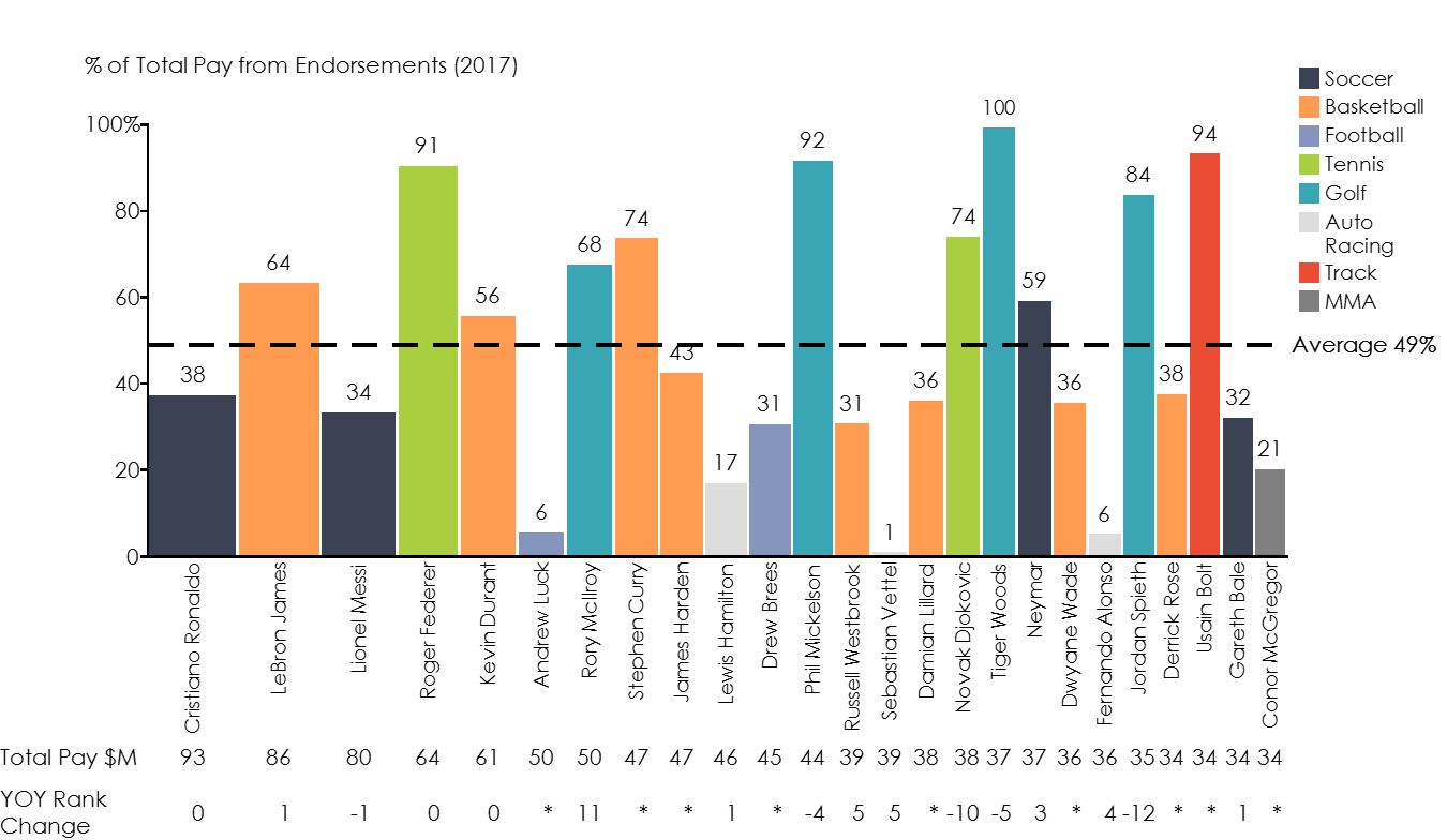
What’s the headline?
What are the most pressing points you want to make with your graph?
What’s the headline?
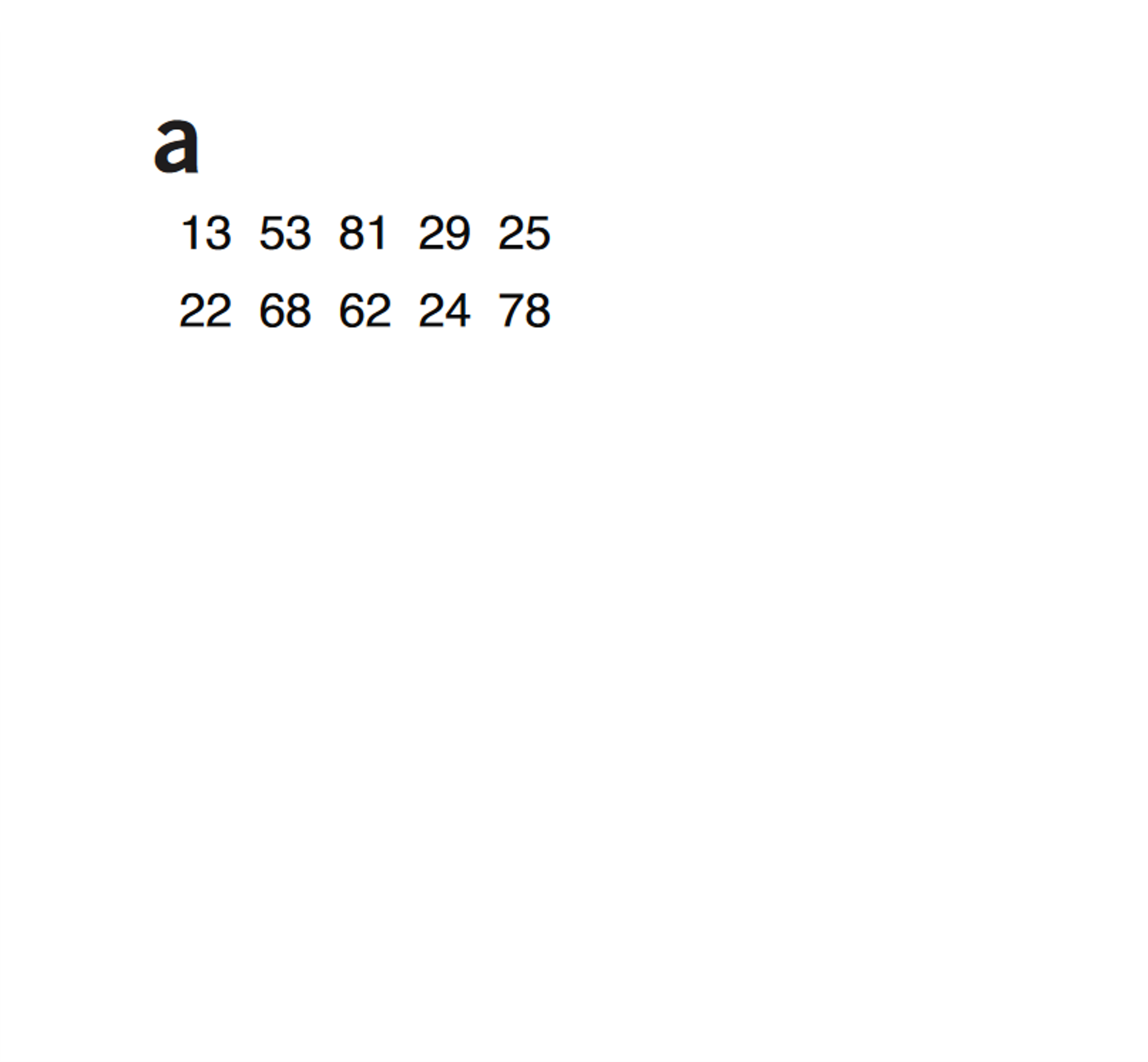
Krzywinski, Martin, and Alberto Cairo. 2013. “Storytelling.” Nature Methods 10 (8): 687–687. https://doi.org/10.1038/nmeth.2571.
What’s the headline?
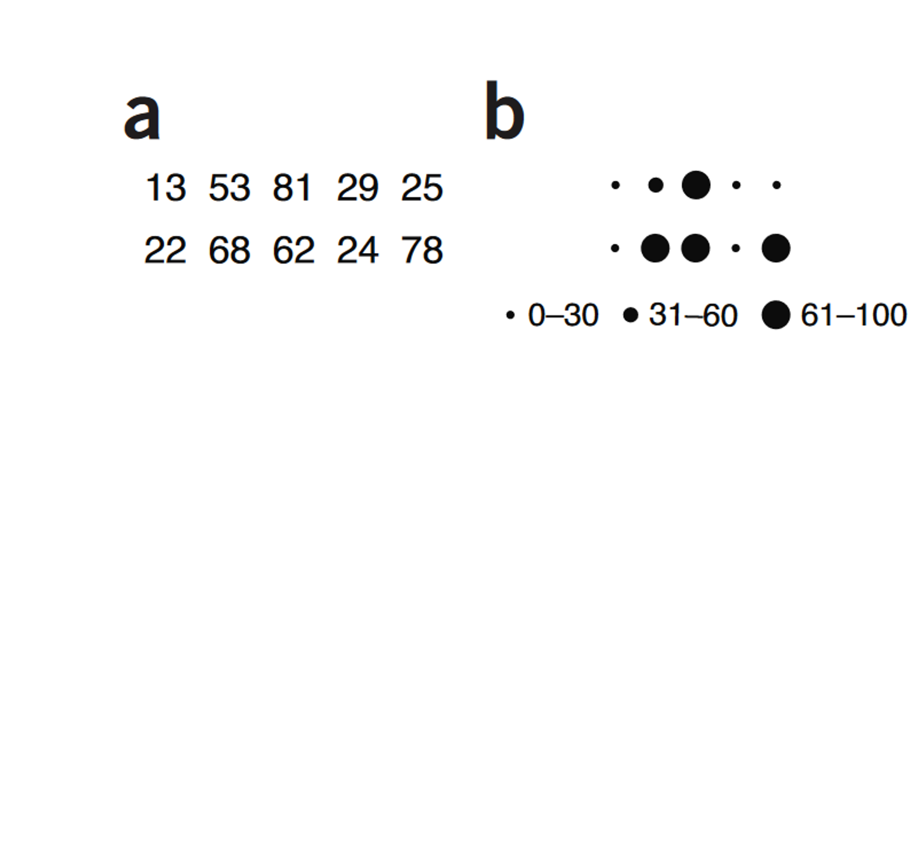
Krzywinski, Martin, and Alberto Cairo. 2013. “Storytelling.” Nature Methods 10 (8): 687–687. https://doi.org/10.1038/nmeth.2571
What’s the headline?
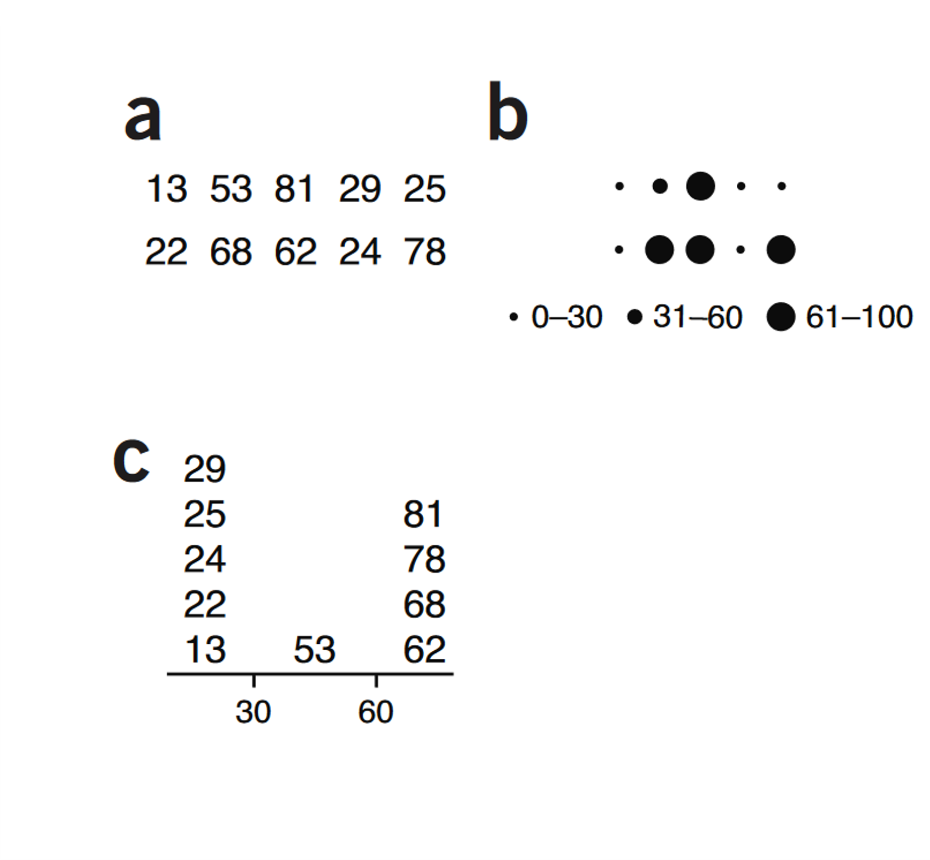
Krzywinski, Martin, and Alberto Cairo. 2013. “Storytelling.” Nature Methods 10 (8): 687–687. https://doi.org/10.1038/nmeth.2571
What’s the headline?
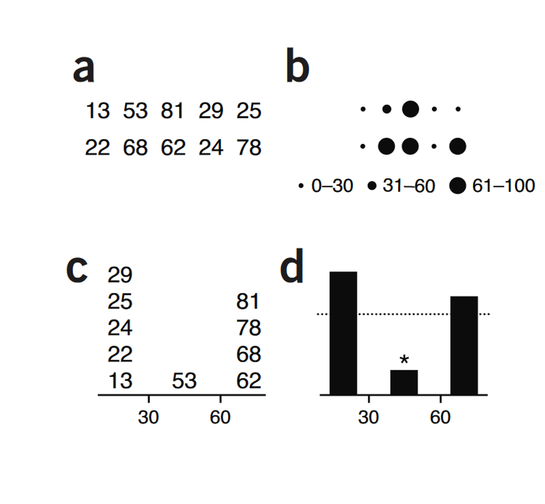
Krzywinski, Martin, and Alberto Cairo. 2013. “Storytelling.” Nature Methods 10 (8): 687–687. https://doi.org/10.1038/nmeth.2571
Catching the eye
It’s easy for the headline to get lost in a data graph. It’s OK to help the audience find it.
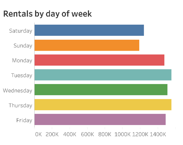
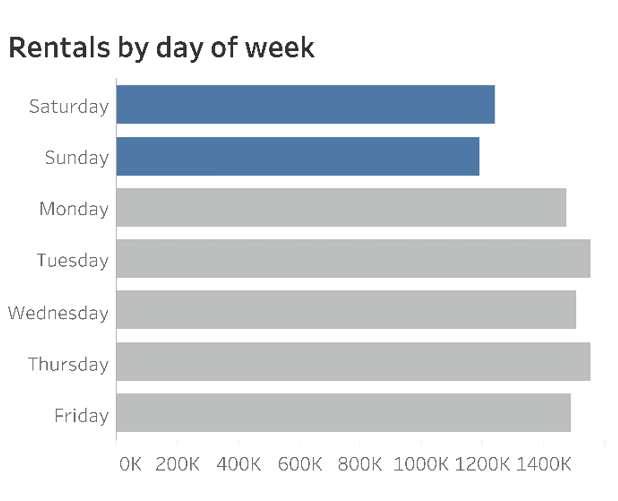
https://www.rashdesign.com/blog/2021/9/24/stevewexler
Drawing the eye to the headline
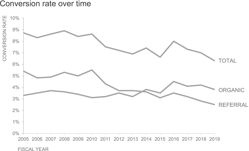
Knaflic, Cole Nussbaumer. 2019. Storytelling with Data. New York: Wiley.
Drawing the eye to the headline
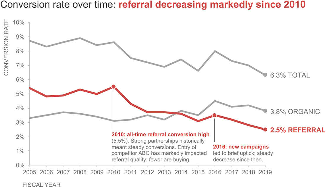
Knaflic, Cole Nussbaumer. 2019. Storytelling with Data. New York: Wiley.
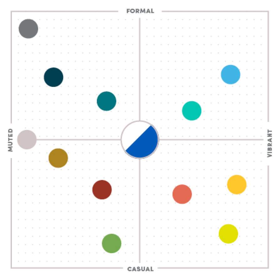
Conveying the mood
Conveying the mood
Maps as storytelling devices
Spatial data
Spatial data is data related to a location

Spatial data
Spatial data is data related to a location
Location
X position (longitude, easting, etc.)
Y position (latitude, northing, etc.)
Z position (elevation [optional])
Attributes (literally anything else)
Name
ID number
Species
Weight
Color
Condition
Recording method
Spatial data models
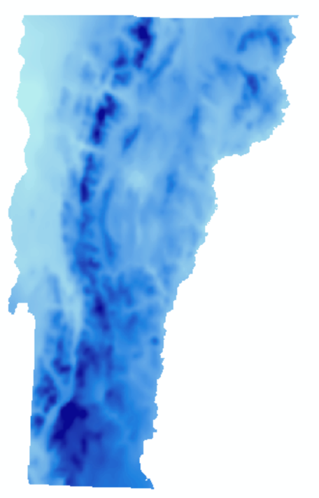
Vector

Raster
The sf package
The simple features or sf package gives R functions for handling vector data and interfacing it with the tidyverse.

The sf package
vernalPools<-st_read("data/GISDATA_CVP_PTPOINT.shp",quiet=TRUE)

vernalPools<-st_zm(vernalPools,drop = TRUE, what = "ZM")

vernalPools
Simple feature collection with 7881 features and 3 fields
Geometry type: POINT
Dimension: XY
Bounding box: xmin: 34452.43 ymin: 781370.8 xmax: 329087.3 ymax: 958316.4
Projected CRS: NAD83 / Massachusetts Mainland
First 10 features:
cvp_num criteria certified geometry
1 5098 Obligate Species, Fairy Shrimp 2009-05-31 POINT (101876.8 878024.9)
2 4385 Obligate Species 2007-01-08 POINT (124514.6 895968.7)
3 7707 Obligate Species 2016-12-29 POINT (253914.4 830115.9)
4 7627 Obligate Species 2015-08-06 POINT (119130.7 877295.4)
5 1826 Obligate Species 1999-07-15 POINT (188430.5 937917.1)
6 4622 Obligate Species 2007-10-17 POINT (213979.5 863452)
7 6711 Obligate Species 2012-06-11 POINT (271080.4 935932.4)
8 1306 Obligate Species 1997-09-18 POINT (103664 872042.3)
9 6997 Obligate Species 2013-02-27 POINT (238222.5 927072.7)
10 3441 Obligate Species 2004-06-17 POINT (199376.9 865967.6)The sf package

This week
Working with vector data in R
Making data spatial
Making maps with ggplot2
